Real Estate Maps
Posted on 3/27/2023 by Steve Robbins
While providing real estate services, we see maps, lots of maps!
Here is a non-comprehensive list and description of several types of maps we may encounter for a specific property:
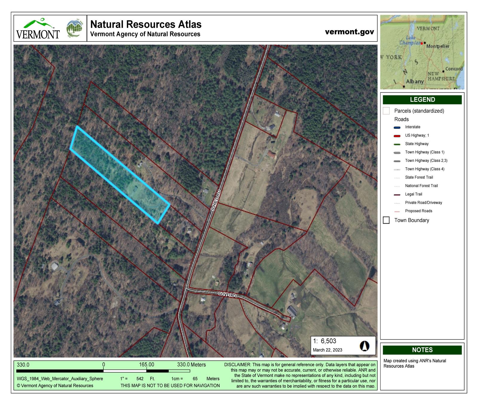
Tax Map – Also called a Parcel Map. These are produced by the town, showing individual parcels which appear on the Grand List. They typically also show roads and may include parcel identification numbers.
Survey – A survey is a detailed map produced by a licensed surveyor following extensive field work and research. Surveys include distances and compass headings of property lines, the total acreage contained within and much, much more. The Legend will usually include roads, trails, water courses, stone walls, fence lines, what type of corner monument, iron pin, stone piles, old trees, etc. A Survey will include a general locator, an indication of true north as well as magnetic north, names of adjoining landowners, the date of completion and notes about title and research details from the town’s land records.
Topographic Map – Commonly called a “topo” map for short, showing the lines of elevation or contour lines. The legend will include the elevation change of each line, typically ranging from 5 – 50 feet each. The closer together these contour lines appear, the steeper the slope depicted. Flat areas show with lines much further apart. Stream courses many times appear as a “v” shape, defining the steeper banks.
Overlays – Most towns and the state of Vermont produce any number of overlays to tax maps including zoning boundaries, flood hazard districts, wetlands, aerial photos and drilled well locations to name a few.
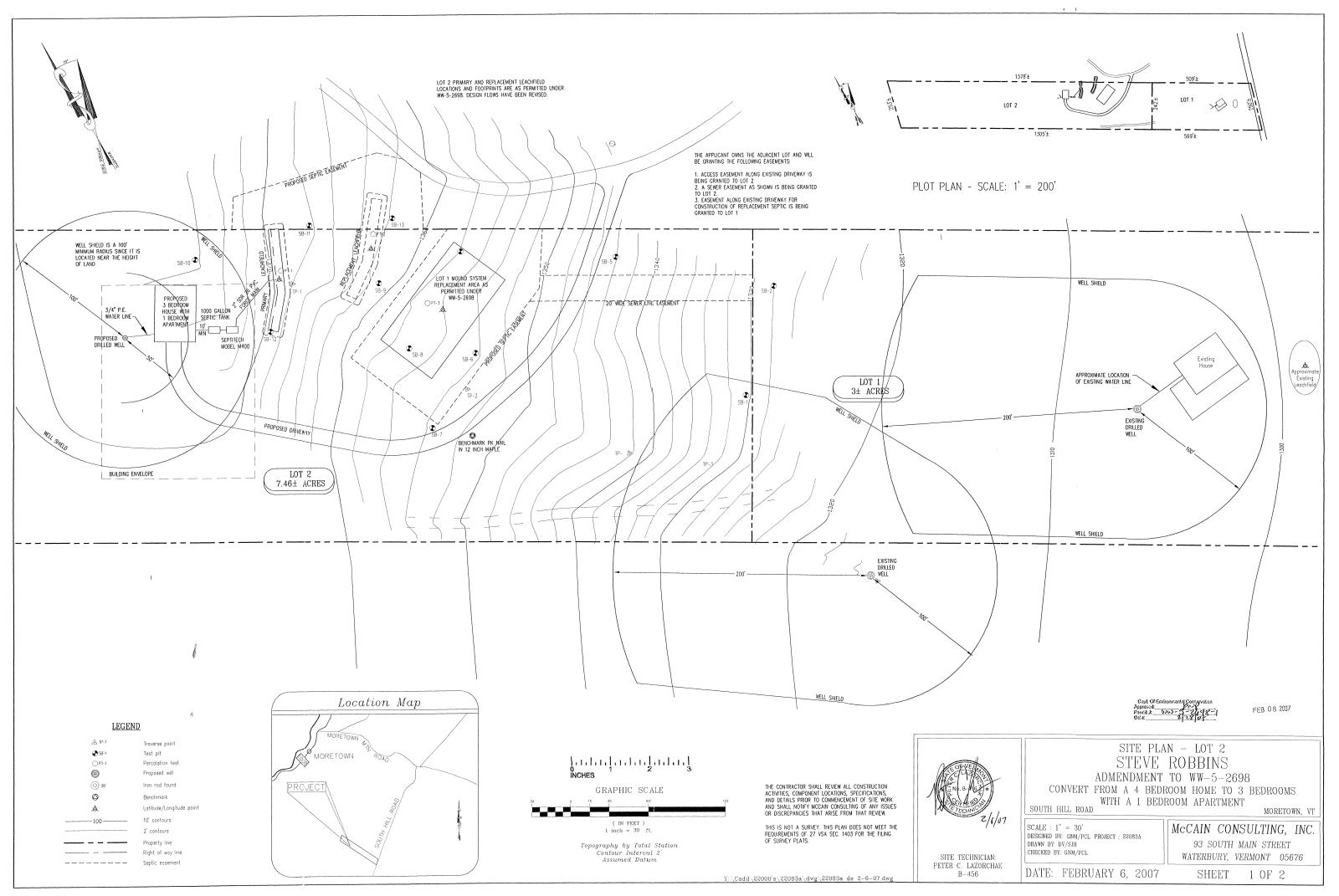
Site Plan – This is a detailed, close-up of a portion of a property for development purposes. It typically shows the proposed driveway access to a home site. It also includes the septic and well locations along with protective areas around both or “shields” within which no other wells or septic systems can be located. Site plans show distances of all the above to property boundaries (“setbacks”), contour lines and other site details like wetlands, boulders, streams, etc. Produced by engineers for permit applications, these also reference additional maps with construction details as needed for septic system, water system, road construction, storm water control and retention walls.
Forestry Map – These are completed by a forester and show different trees species or “stands” of trees, typically part of a forestry management plan.
At www.mrvre.com , we love to talk about maps and real estate. Please call or email anytime!